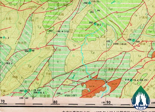


Qijiehe River originates from Phoenix mountain in the southwest of Zhijin County with the full length of 30km. Wherein: (1) in the upstream (it is also called Qimohe River, not included in the scope of geopark) , the river is wide and flows gently,and there are shallow underground water and many springs with abundant water at both banks.(2) In the downstream (basically in the scope of geopark), the river flows from Lijiazhai to Liuchonghe River, extends towards northeast and runs both aboveground and underground alternatively. It submerges into underground for several times to form underground river sections. Finally it submerges into underground at Dacaokou and converges to Liuchonghe River after flowing towards northeast for 2km.(3)The flow in dry season is 3-5 m3/s, but in flood period, it can reach dozens of or nearly one hundred flows, and the cutting of river is severe with the depth of 100-330m.